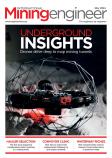


John Frost explains how a large gold mine uses drone visualisation to measure stockpiles
When it comes to daily progress tracking with drones, few companies are operating on the scale of Nevada Gold Mines, a 40-mile stretch of land with four operating pits, which comprise one of the largest gold-producing complexes in the world.
To map, measure, and share accurate information about worksites, Nevada Gold Mines is using Trimble Stratus, a software that uses drones to enable quicker decisions, avoid mistakes, and grow profits. Powered by Propeller, this tool allows Nevada Gold Mines’ chief surveyor, Ben McKnight, to accurately measure stockpiles and make critical decisions based on how the site changes every day.
McKnight employs a high-tech surveying team with 17 field techs, 11 of whom are licensed drone pilots. Every morning, his team flies its armada of drones, gathering information his engineers and managers need to make smarter mining decisions.
Measuring stockpiles with heightened accuracy
While McKnight uses drone data for a variety of use cases, the most important is stockpile management. As one of his primary responsibilities, McKnight documents how much of each material the mine has on hand so it can frequently report these quantities to the materials processing plant. At the end of each month, McKnight must ensure that the drone data of material excavated, processed, and moved reconciles with his accounting.
Before Propeller, McKnight used terrestrial lidar for stockpile monitoring, but lacked the accuracy necessary for the size and scope of the project. Once he switched to drone visualisation, he immediately noticed a 30% discrepancy in the company’s stockpile inventory reporting with these old systems. McKnight employs AeroPoints, Propeller’s smart ground control points that allow him to obtain survey data to within a ¼-foot level of accuracy or less, to make sure the materials on the ground match up with his accounting calculations. In fact, when using Propeller's recommended workflow, PPK customers can expect to achieve up to a tenth of a foot accuracy by using these ground control points. McKnight and his team conduct surveys early in the morning, flying multiple drones to cover the massive site. By 11am, the data has been captured and uploaded to Propeller where it is processed into a current picture of materials available for McKnight and the materials processor.
On a site as consistently evolving as Nevada Gold Mines, daily drone flights are important to obtain an accurate understanding of how stockpiles change in real time, especially since some stockpiles have materials added on top of them throughout the day. In addition to the morning drone flight schedule, McKnight sometimes orders shorter drone flights to recalculate materials on-site, creating more accuracy for the team. One final longer drone flight at the end of every month provides a more granular view of the site, ensuring that actual stockpile volumes line up exactly with accounting records.
With accurate stockpile data, McKnight can easily export it into a comprehensive report on stockpiles and share it across the organization, enabling anyone on the greater Nevada Gold Mines team to easily read and understand the data. Nevada Gold Mines’ metallurgical department integrates Propeller’s software with their own tracking platform to import the report and automatically update their material trackers.
Choosing the right software
For McKnight, technological adoption has long been a top priority; he’s been experimenting with integrating drones into his teams’ workflows for over a decade. For him, the best drone software eliminates bottlenecks while managing terabytes of inbound survey data for each flight. On top of that, McKnight sought to expand beyond stockpile measurement to tasks such as inspecting haul roads.
With the latest iteration of software, McKnight’s team shares large orthophoto and point cloud files more easily with parties inside and outside the organization, while avoiding having to store heaps of data on their local devices. Propeller’s interactive and realistic 3D models help McKnight distill complex survey data into visual representations that his non-surveyor co-workers can understand, saving time and streamlining communication. With Propeller’s coordinate system flexibility, McKnight can apply drone surveys to different data sets, all referenced through WGS 84. In the case of Nevada Gold Mines, the site operates two older mining locations, originally set up in different, non-localised coordinate reference systems, so coordinate flexibility helps McKnight maintain consistency across these sites. Finally, Propeller's ease of use allows the team to quickly pull stockpile volumes and measurements on their own, eliminating bottlenecks and delays in getting to the data. Propeller's adaptability to different drone hardware, including the DJI Phantom 4 RTK, means McKnight doesn't have to worry about interrupted service with Propeller should he need to change or upgrade a drone in his fleet.
With accurate drone surveys in hand, McKnight and his team have boosted profitability, efficiency, and materials tracking accuracy across one of the largest gold-producing complexes in the world, setting the gold standard for what’s possible with drone surveying.
John Frost is with Propeller Aero